For those of us who have naturally aspirated heavy vehicles, these graphs may be of some use.
Thanks to http://www.gpsvisualizer.com/elevation for the tool!
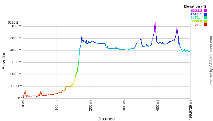
The standard route (I-5 South to Hwy 58 to Hwy 97 to K-Falls to Hwy 139 to Hwy 299 to Hwy 447 to Gerlach, NV) Shortest with most pre-elevation low-altitude driving (better MPG at lower altitudes).
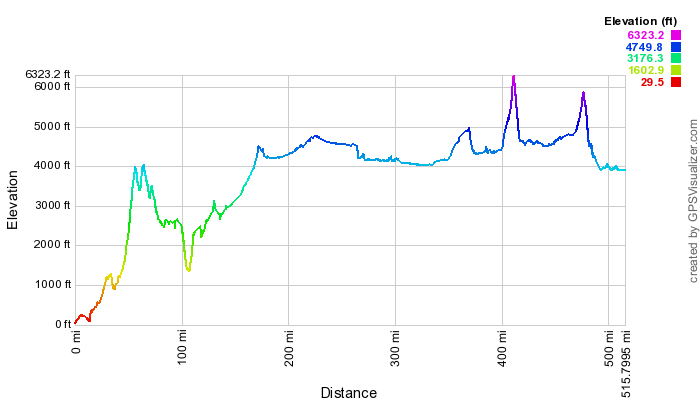
This route is very similar except travels up over 26 and directly onto 97 (lots of higher altitude driving and a fair amount of decent/climb. (Hwy 26 E to Hwy 97 to K-Falls to Hwy 139 to Hwy 299 to Hwy 447 to Gerlach, NV)
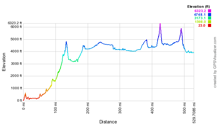
This route is using Hwy 22 out of Salem. (I-5 South to Hwy 22 to Hwy 97 to K-Falls to Hwy 139 to Hwy 299 to Hwy 447 to Gerlach, NV) Not as much low altitude driving as the 58 route, but it does have a nicer climb profile. I’ve done this route and it’s not too bad but you definitely notice running up around 3000-4000ft right off the freeway.
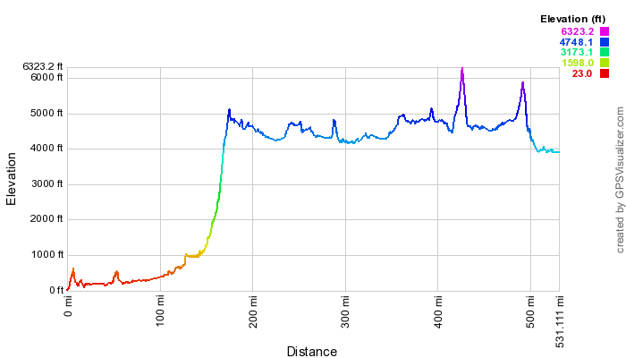
This is the ever popular route that uses Hwy 58 but passes by SummerLake hot springs. (I-5 South to Hwy 58 to Hwy 97 to Hwy 31 to Hwy 395 to Hwy 299 to Hwy 447 to Gerlach, NV). The length is a bit longer than the K-falls route and has a few more random bumps with steep peaks along the way, but the SummerLake option is a nice one.
Hope these are useful!